The #1 App For Oilfield Navigation


About OilTrails
Navigating the Roads Less Travelled
Born from the needs of Alberta oilpatch workers in 2012, OilTrails started as a simple LSD finder solution to the confusing directions often provided by dispatch. Originally designed to provide precise navigation to Legal Sub-Divisions (LSDs), our app has significantly expanded its capabilities over the years.
Today, OilTrails offers comprehensive features including offline LSD and National Topographic System (NTS) lookups, detailed well data for enhanced site accuracy, and real-time weather updates. Users can also choose from multiple navigation providers for optimal route planning. Our user-friendly interface ensures you can effortlessly reach remote oil and gas sites across Western Canada.
Available on iOS, Android, and via our web app, OilTrails ensures a seamless experience across all devices and is your trusted lease locator.
4.7
/ 5
Canadian iOS Store Rating
App Features
More Than Just a Lease Locator
Offline LSD and NTS Lookups
Find any location in Western Canada, with or without service
Accurate Well Locations
Our database of over 3 million well records allows for greater accuracy over simple LSD lookups.
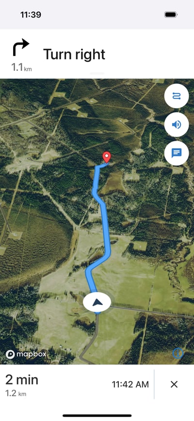
Turn-By-Turn Navigation
GPS directions to oil and gas locations even if cell service is lost.
Well Data
Get up to date well information such as drill date, depth, operator, well fluid, and more!
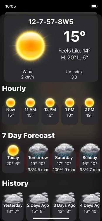
Lease Specific Weather
On site weather information that includes hourly and daily forecasts; as well as previous days, so you'll know if it's wet out there.
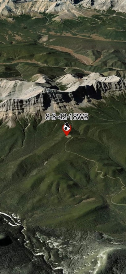
3D Satellite Maps
OilTrails has 3D satellite mapping with HD quality that helps you find the best route to location, even if that ice road or goat trail isn't in our map system.
Cloud Storage and Sharing
Save and sync locations between devices and easily share well locations with contacts.
Save and Favorite Locations
View previous locations, favorite them, or rename them for easy access.
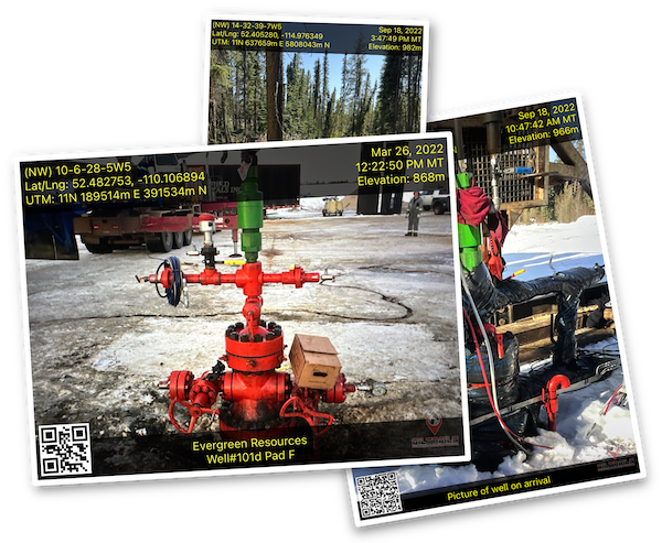
GeoPics
Take and share geo stamped photos. The photos include date/time/zone, location coordinates, a Google Maps location QR code, and an optional customizable comment.
What the Oilfield is Saying About OilTrails
Real feedback from the people who keep the oilfield moving.
This is the best app out there. I am an oil tank truck driver, and this app finds any wellsite. It will also offer you the correct surface location when you enter downhole locations.
Have used OilTrails for better part of 14 years now. Simply awesome!
Best app on the market.
I’ve been using OilTrails for a few years and it works awesome! Even have coworkers ask me for directions, well worth it.
Best app I've tried out there
OilTrails is an excellent product. I use it frequently. 👍👍
Have it, wouldn't be without it
I use the OilTrails software and rely on the LSD lookup and the built-in GeoPics. It’s a one-stop shop for project photos and navigating. I love it.
Works like a charm
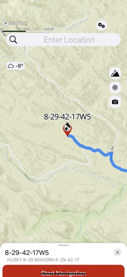
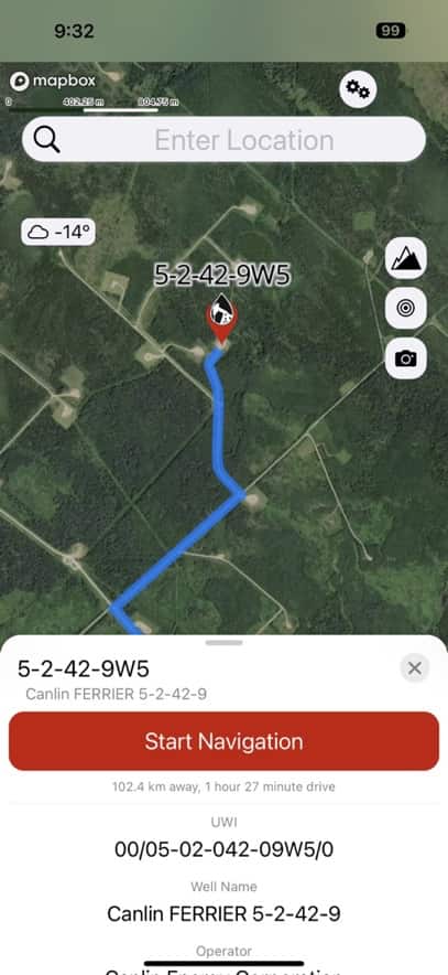
Finding Locations
User Friendly and Simple to Use
Locating leases could not be easier!
Tap the "Enter Location" field
Use the intuitive LSD selector to enter your location
*To enter NTS, Well Name, UTM, API#, or ENO# disable the 'LSD Picker' option in the Settings menu
The app will fly to the selected location
(If there are multiple wells on the selected location, the app will prompt you asking which well data to use)
Tap 'Start Navigation' to begin turn-by-turn navigation
Get NowHow To Get Started
3 Easy Steps
Start Your Free Trial
All new users enjoy a no obligation, 30 day free trial
Start Finding Locations
Impress your friends with your newfound sense of direction
Get it Now
Download The Latest Version Of OilTrails
Get Canada's top lease locator app now from the App Stores
Included With OilTrails

GeoPics allows you to take a picture with your device camera and have your location
information, timestamp, and a location QR code stamped on it. Useful for field operations to
share details and location coordinates in one easy step.
If you live in Western Canada the LSD and NTS coordinates will be included along with GPS
and UTM coordinates and elevation. The time stamp includes date, time with seconds, and time
zone.
After taking a picture you can add a comment. Save the GeoPic to your photo library or send
it to someone in your contracts.
The QR code allows other to quickly view the location on a map by either scanning it with a
smartphone camera or long tapping on it if the photo is on their device.
The OilTrails version of GeoPics allows the removal of the photo watermarks.
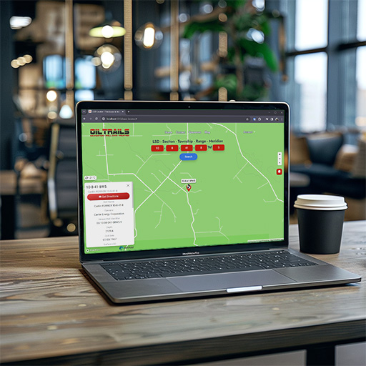
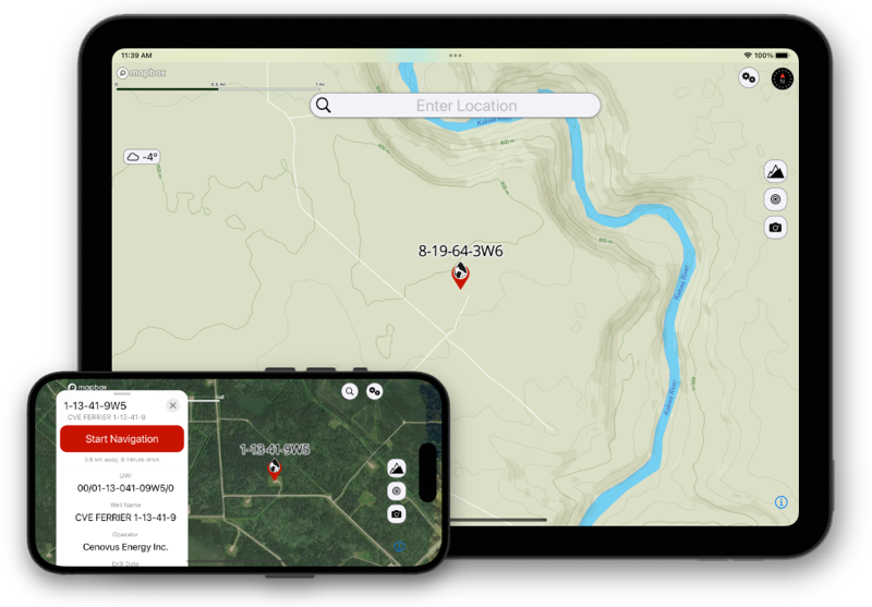
OilTrails for Browsers
Introducing OilTrails for Browsers, the desktop-friendly version of our comprehensive oil and gas lease locator.
Designed to complement our mobile app, OilTrails for Browsers brings the full power of lease and well site
location directly to your web browser. Now you can access detailed well data, reverse geocoding, and real-time
weather updates with ease from your desktop or laptop.
Perfect for professionals in the field or at the office, OilTrails for Browsers ensures you have the information
you need, when you need it. Sync your findings with mobile devices for seamless integration and utilize our direct
Google Maps integration for straightforward planning and navigation.
Log in or create a free account today to start exploring the vast potential of your operational and
exploration planning with unmatched convenience and efficiency.
Check Out Our Other Oilfield Apps
Like the samples at the grocery store they're all free, but you don't have to feel guilty for taking more than one.


Select tubing/casing size and depth to calculate volumes.


Calculate stretch/compression needed for setting tubing anchors and packers


Enter the pump coefficient and tap the screen with your strokes to calculate pump rate.
Take and share geo stamped photos.