LSD and NTS Locator
LSD and NTS Locator
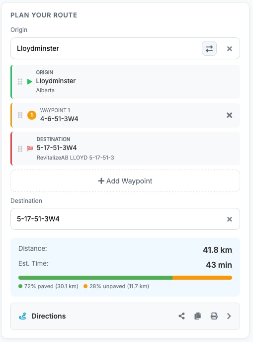
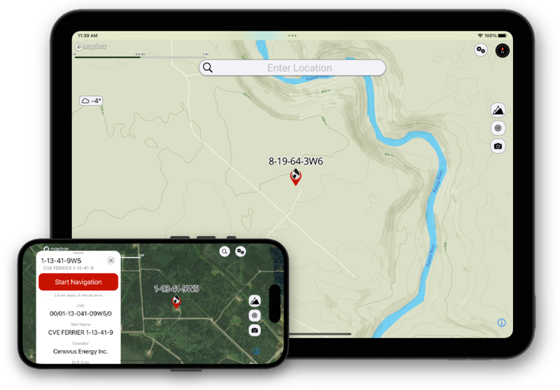
OilTrails Navigation includes LSD and NTS locator tools built for
oilfield work across Western Canada. If your team is searching for a
practical LSD locator, a clear LSD map view, or an oilfield route
planner that can move from lookup to route creation without tool
switching, this page is designed to do that.
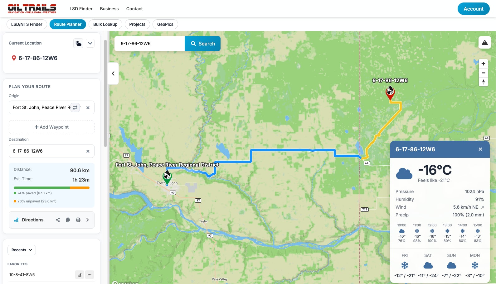
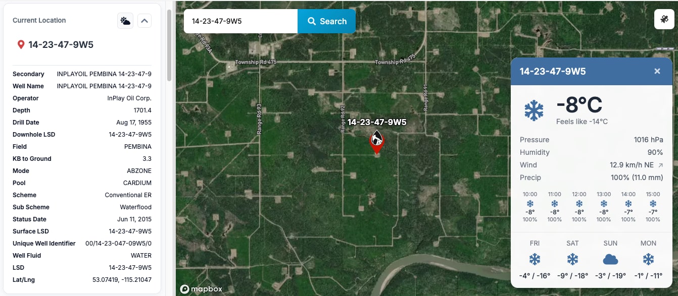
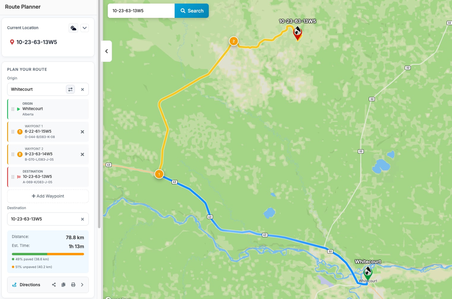
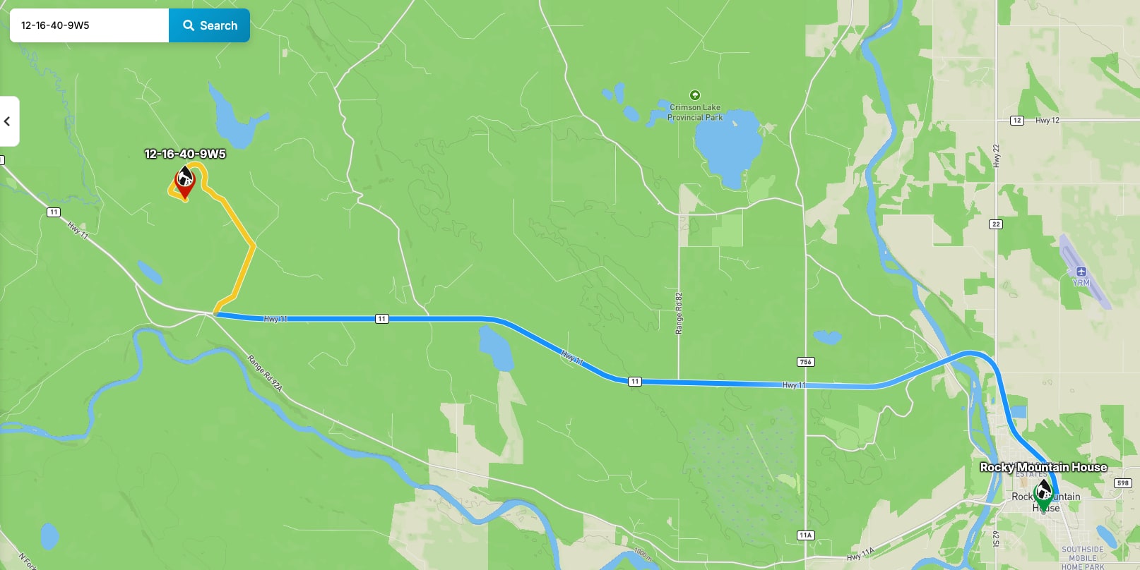
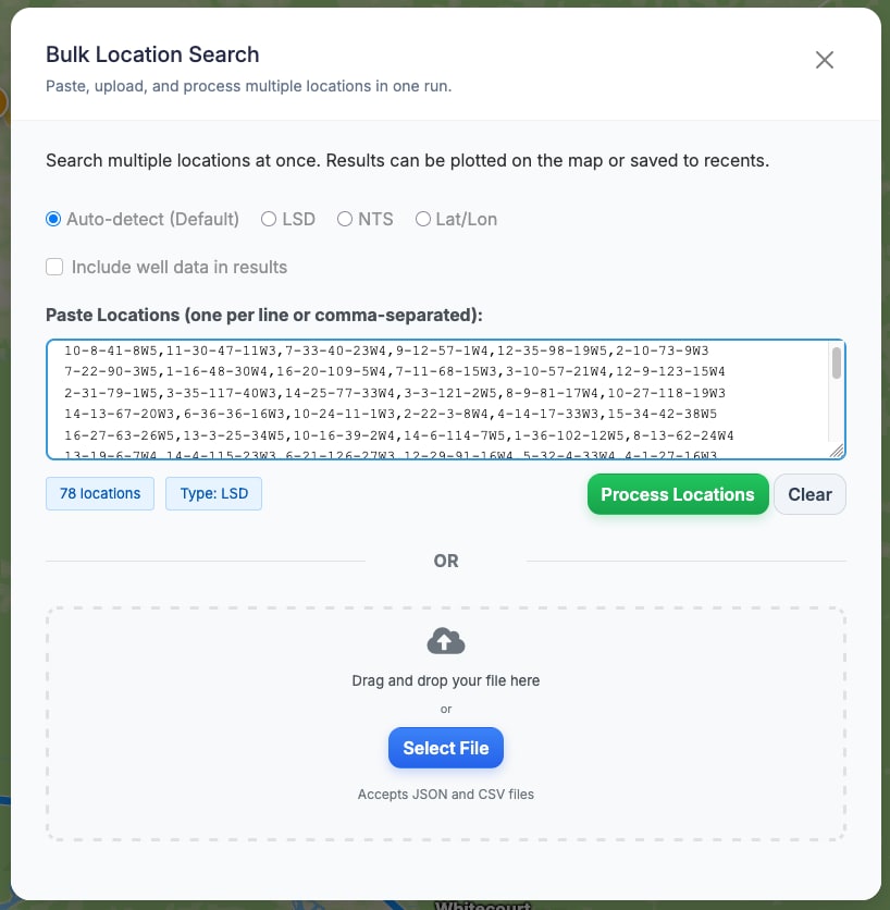
You can search Legal Land Description entries across
Alberta, Saskatchewan, and British Columbia, convert LSD locations
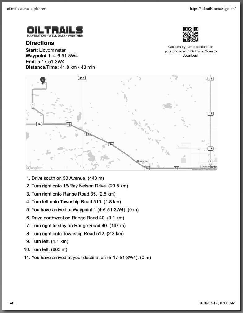
into map coordinates, and then move directly into route planning. That
means fewer copy-paste errors, faster dispatch preparation, and more
consistent instructions for field crews.
For users searching specifically for an
Alberta LSD finder, a
Saskatchewan LSD map, or a
BC oilfield map, OilTrails Navigation brings those
needs into a single workflow that combines location lookup, map
context, and routing tools. The result is a navigation process that is
easier to scale from one trip to many projects.
NTS Locator for BC and Western Canada Workflows
The built-in NTS locator is designed for teams that regularly work in
NTS-indexed regions and need to validate location context before
dispatching field crews. Instead of treating NTS lookup as a separate
task, OilTrails allows NTS search to feed route planning and project
organization in the same workspace.
Whether your team is looking for an LSD map tool, a reliable NTS
locator, or a full oilfield navigation toolkit, OilTrails helps
connect office planning with on-the-ground execution.
Instead of relying on disconnected resources for LSD lookup, NTS
search, and routing, teams can start from one tool-focused page and
move directly into the navigation workspace.