GeoPics 2.0: Now Available to Test
Persistent library, batch export, and enhanced geo-camera features.
April 26, 2025
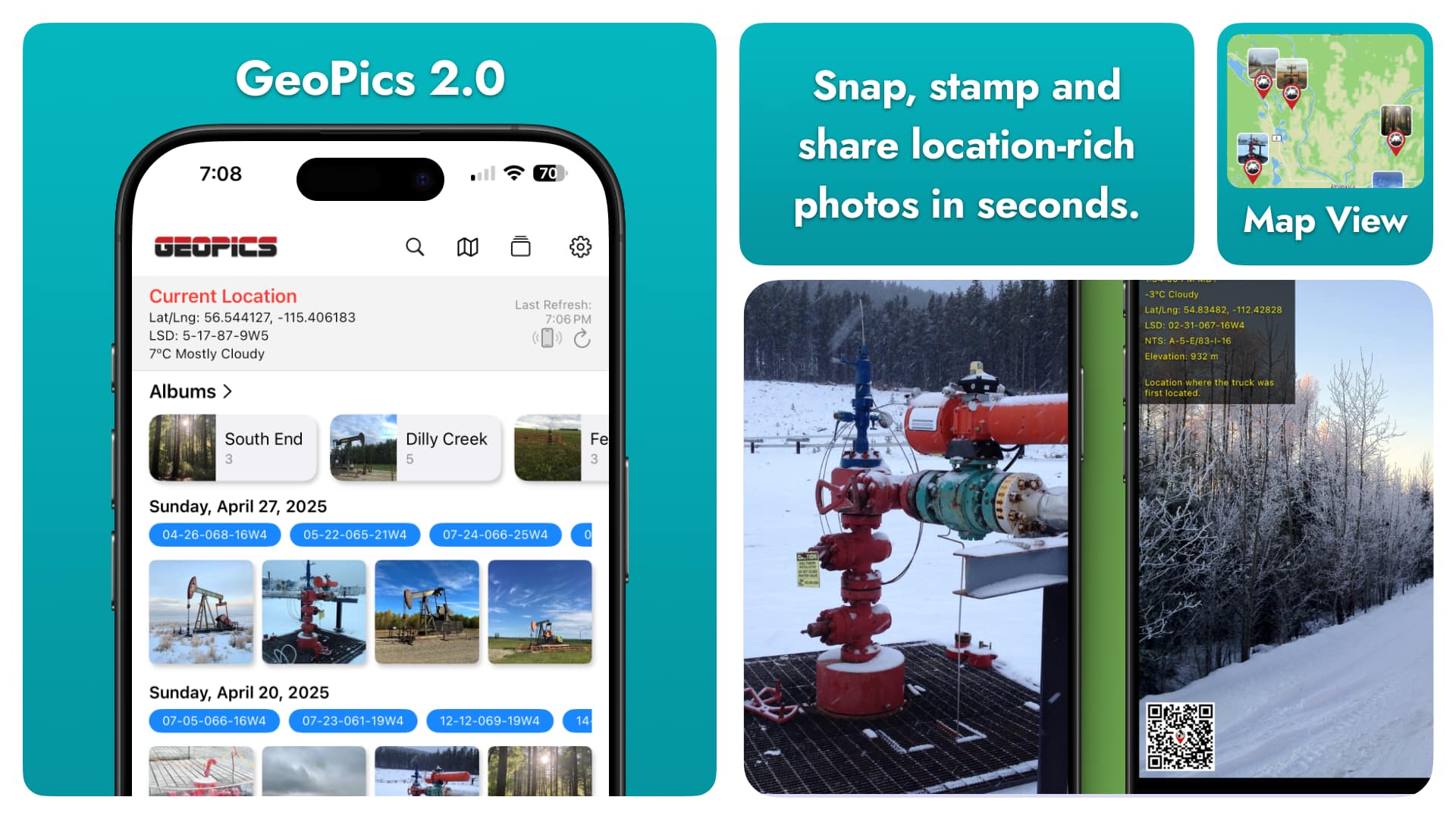
Whether you’re a field engineer logging site progress, a surveyor marking waypoints, or an outdoor photographer capturing landscapes, keeping your images organized and accurately stamped can be a challenge. GeoPics 2.0 solves that with a major update: a persistent, user-friendly gallery view that keeps your photos at your fingertips—no matter where you are in the app.
Snap Geotagged Photos in One Tap
GeoPics has always made capturing location-rich images simple:
- Built-in Geo-Camera with live preview, flash control, and selectable photo quality
- Automatic Stamps for date & time (with seconds + time zone), GPS coordinates, and a scannable QR code
- Custom Overlays: include elevation, UTM, and (in Western Canada) LSD & NTS fields, plus your own comments
Every shot is stamped in-camera, ensuring your metadata remains accurate and immutable.
Gallery View: Your Photos, Always at Hand
In earlier versions, leaving GeoPics meant you couldn’t quickly revisit your captures. GeoPics 2.0 introduces a powerful Gallery View:
- Persistent Library: all photos stay in GeoPics, even when you navigate away
- User-Friendly Interface: scrollable, date organized gallery with thumbnails and locations
- Edit on the Fly: tap any image to update comments, tags, or overlay settings post-capture
- Batch Export: select multiple photos and export them together
No more lost shots, manual file management, or repeat annotations. Your entire field album lives in one place.
Explore & Organize on a Full-Screen Map
Review and sort your photos geographically:
- Interactive Map Browser: pan, zoom, and tap pins to preview thumbnails
- Comprehensive Coordinate Support: GPS, UTM, elevation—and LSD & NTS where applicable
- Dynamic Albums: group shots by project, date, or custom criteria; rename and reorder as you go
- Metadata Search: filter by date range, location, keywords, or custom tags
Find exactly the photo you need—no endless scrolling required.
Favorites & Instant Sharing
Flag your best images and get them out fast:
- Favorites Album: mark top photos for one-tap access
- Share with Context: save to Apple Photos or send via iMessage, SMS, or Email with all stamps and QR codes intact
- Report-Ready Exports: include QR codes in project documents or presentations for instant location lookup
Try GeoPics 2.0 Today & Share Your Feedback
GeoPics 2.0 is in public beta on TestFlight—download now and help us refine the features that matter most:
👉 Download GeoPics on TestFlight
We’re excited to hear how the new Gallery View fits into your workflow. Got ideas for improvements or new features? Let us know and shape the future of GeoPics.
Never lose track of your field photos again. GeoPics 2.0 keeps every shot—time, place, and all the details—just a tap away.
Note: This is a beta release. Some features may be incomplete or require further testing. Your feedback is invaluable in making GeoPics the best it can be! Upon release, GeoPics will be available as a stand alone app on the App Store, and also available within the OilTrails App. The stand alone app will be completely free. The OilTrails version will offer the same features, but will also allow for the removal of the watermark.