Understanding Western Canada's DLS Grid System
Why the Dominion Land Survey still shapes oilfield navigation today.
May 26, 2026
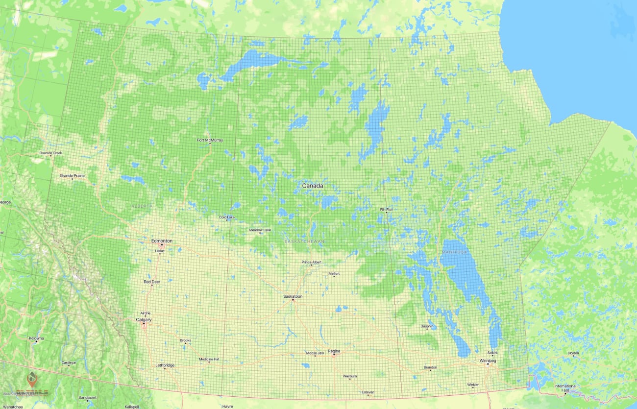
For over a century, Western Canada has relied on a massive land grid system that still shapes how the oilfield operates today. Long before GPS navigation, satellite imagery, or smartphones, the Prairies were divided into a structured survey system known as the Dominion Land Survey (DLS).
Today, that same system remains deeply embedded in oil and gas operations across Alberta, Saskatchewan, and parts of British Columbia and Manitoba. Wellsites, leases, access roads, land agreements, and dispatch instructions are still commonly referenced using Legal Land Descriptions (LLDs) and Legal Subdivisions (LSDs).
Even with modern digital mapping, the DLS grid remains the language of the Western Canadian oilfield.
What Is the Dominion Land Survey System?
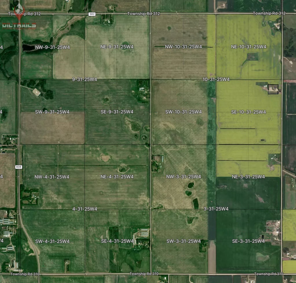
The Dominion Land Survey system was introduced by the Canadian government in the late 1800s to organize and divide Western Canadian land for settlement and development. The system created a giant rectangular grid stretching across the Prairies.
Rather than using latitude and longitude, land was divided into increasingly smaller sections using a hierarchy of:
- Meridians
- Ranges
- Townships
- Sections
- Quarter Sections
- Legal Subdivisions (LSDs)
The result was a standardized land framework that could be referenced consistently across large areas of Western Canada.
Although originally designed for agriculture and settlement, the DLS system eventually became foundational to the Canadian oil and gas industry.
Why the Oilfield Still Uses DLS Locations
Even today, many field operations still communicate locations using LSD coordinates rather than GPS coordinates.
You might hear locations shared like:
8-1-51-14W4
To someone outside the industry, that can look cryptic. To oilfield workers, dispatchers, land departments, and operators, it immediately identifies a precise area of land.
The DLS system remains important because it is deeply connected to:
- Wellsite identification
- Surface land agreements
- Regulatory reporting
- Lease boundaries
- Access planning
- Rural road systems
- Historical oilfield records
In many cases, the legal land description is still the official location reference for a site.
Understanding How a DLS Location Works
A DLS location becomes more specific as you move through the hierarchy.
Using this example:
8-1-51-14W4
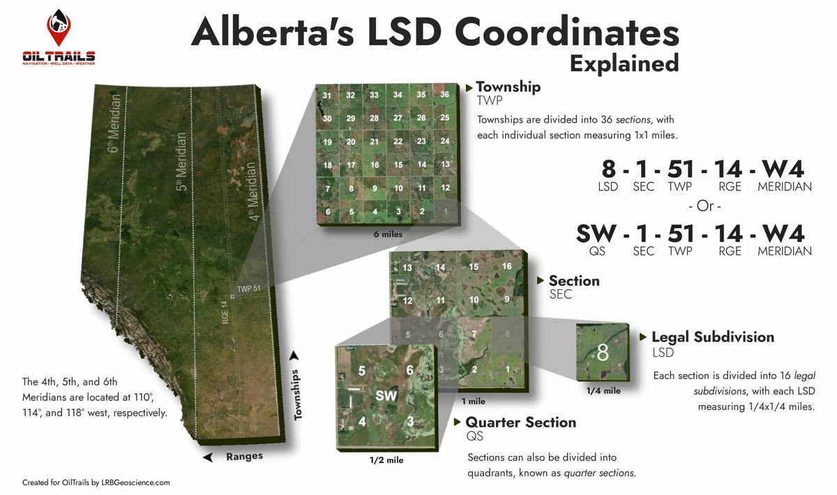
Here is what each part represents:
LSD “8”
The specific Legal Subdivision within the section.
Section “1”
One of 36 sections within a township.
Township “51”
The horizontal township row.
Range “14”
The vertical range column.
“W4”
West of the 4th Meridian.
Each township contains 36 sections, and each section can be divided into 16 Legal Subdivisions. This allows locations to be narrowed down to relatively small areas of land while still fitting into the larger Prairie grid system.
If you want a more province-specific breakdown, see our guide to Alberta LSD locations.
Why DLS Coordinates Can Be Difficult
While the DLS system works extremely well for land management and industry operations, it can be difficult to visualize on modern consumer maps.
Traditional navigation apps generally do not understand DLS coordinates directly. That creates several challenges:
- Manually converting LSDs to GPS coordinates
- Difficulty visualizing township layouts
- Confusion around ranges and meridians
- Increased potential for navigation mistakes
- Reliance on external map books or conversion tools
For years, many workers carried printed township maps or relied on separate lookup systems just to understand where a location physically sat on the map.
DLS vs GPS Coordinates
GPS coordinates and DLS coordinates serve different purposes.
GPS Coordinates
GPS is universal and highly precise for navigation. Consumer mapping platforms like Google Maps and Apple Maps are built around latitude and longitude.
DLS Coordinates
DLS coordinates are built around land ownership and land organization. They are easier for industry operations that work directly with leases, sections, and legal land descriptions.
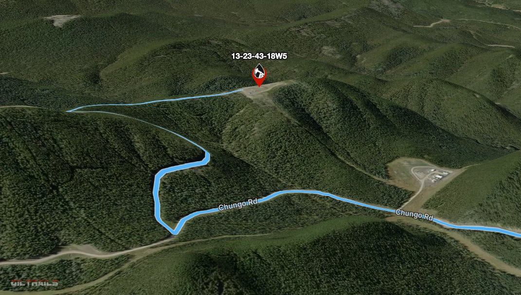
Modern oilfield navigation often requires bridging both systems together by translating legal land descriptions into usable navigation routes.
Modern Digital DLS Mapping
The shift from paper map books to digital mapping has dramatically improved how oilfield workers interact with DLS locations.
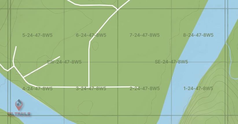
Modern GIS systems and oilfield navigation platforms can now overlay DLS grids directly onto live maps, satellite imagery, and routing systems.
This provides several advantages:
- Faster location awareness
- Easier route planning
- Improved field navigation
- Better collaboration between crews
- Reduced entry errors
- Easier understanding of surrounding land structure
Instead of mentally interpreting township layouts, users can now visually see the grid directly on the map.
DLS Grid Overlays in OilTrails
OilTrails now includes live DLS grid overlays across supported areas of Western Canada.
The overlays allow users to visually display township, section, and LSD boundaries directly on top of the map while navigating or planning routes.
This creates a much more natural workflow for users already familiar with the DLS system.
Features include:
- Township and LSD grid overlays
- Satellite, terrain, and road map support
- Integrated routing and navigation
- Wellsite lookup and planning tools
- Cross-platform syncing between mobile and web
- High-detail mapping built specifically for Western Canadian oilfield operations
On mobile, DLS grid overlays are available to all active subscribers.
On the OilTrails web platform, advanced DLS grid overlays are included with OilTrails Pro.
This allows field users to access the grid directly while navigating on mobile, while planners and office users can work with larger-scale overlays and planning tools through the web platform.
The DLS System Is Still the Backbone of Western Canadian Land Navigation
More than 100 years after it was created, the Dominion Land Survey system continues to influence how Western Canada operates.
From oilfield navigation and land management to infrastructure and agriculture, the Prairie grid remains one of the foundational spatial systems of the region.
While the tools have evolved from paper township maps to modern digital overlays, the underlying grid has remained remarkably consistent.
Understanding the DLS system is still an essential part of working in the Western Canadian oilfield.
Explore DLS Mapping with OilTrails
OilTrails was built specifically for Western Canadian oilfield navigation and planning.
Whether you are navigating to a wellsite, planning routes across multiple locations, or visualizing township layouts directly on the map, OilTrails helps bridge traditional DLS land descriptions with modern mapping technology.
Explore the OilTrails navigation platform, or view OilTrails mobile access to experience live DLS mapping across mobile and web.